印刷
印刷
Honederamura Shoen Iseki
Honederamura Shoen Iseki
For about 300 years from the late Heian period to the early Muromachi period, Honederamura Shoen Iseki, located in the Hondera region of Gembi-cho, Ichinoseki City, was administered as the domain of the Sutra Repository Steward of Chuson-ji in Hiraizumi.
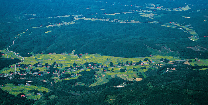
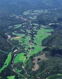 At Chuson-ji, there are two illustrated maps of Honederamura Shoen Iseki drawn in the Kamakura period, which give us a visual clue on what the estate was like in medieval times. And when you walk around the site, you can see for yourself that the landscape has barely changed since when these maps were drawn. The site is one of the few places in all of Japan where you can experience the atmosphere of a medieval estate. For this special nature, Honederamura Shoen Iseki has been designated as a national important cultural landscape, and the places that can be identified from the maps have been designated as national historic sites. With historical documents, illustrated maps, a landscape that is true to the maps, and rare sites from the estate days, a medieval farming village landscape can be found here.
![]()
Location and Environs
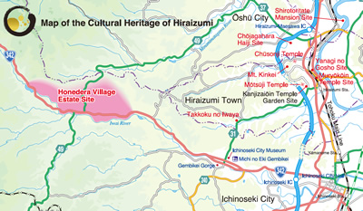 Honederamura Shoen Iseki is located in the Hondera region of Ichinoseki City. After the fall of the Oshu-Fujiwara clan, the extent of the village was determined by Minamoto no Yoritomo as bounded by Kagikake in the east, Sanno no Iwaya in the west, the Iwai River in the south, and the ridgeline from Mitakedo to Masaka in the north. Today, to protect the peripheral environment, the 761-ha area (approximately 7 km east-to-west; 2 km north-to-south) with the 14-km point on National Road 342 heading toward Mt. Kurikoma from JR Ichinoseki Station as the eastern border and Mt. Sanno at the 21-km point as the western border is designated as an important cultural landscape planning zone.